Utility Mapping & CCTV Drainage Surveys
►
Utility Mapping.
►
Specialist Radar Surveys.
►
Post Processed Radar Surveys.
►
CCTV Drainage Surveys.
►
Drainage Condition Reports.
►
Bore Hole Clearances.
►
Trial Hole Clearances.
►
Sonde Locating.
►
Earth Fault Finding.
►
Statutory Records Search.
►
Site Mark Up.
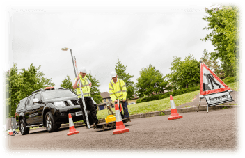
Dando Surveying Ltd provides a start to finish solution for utility mapping, drainage surveying and CCTV drain investigation. These services can be offered either stand alone or in conjunction with our topographical surveying service.
We have many years of experience. We know that locating the position of underground services and pipes is critical before the commencement of any excavation and we are able to provide the vital information needed to avoid potential costly mistakes.
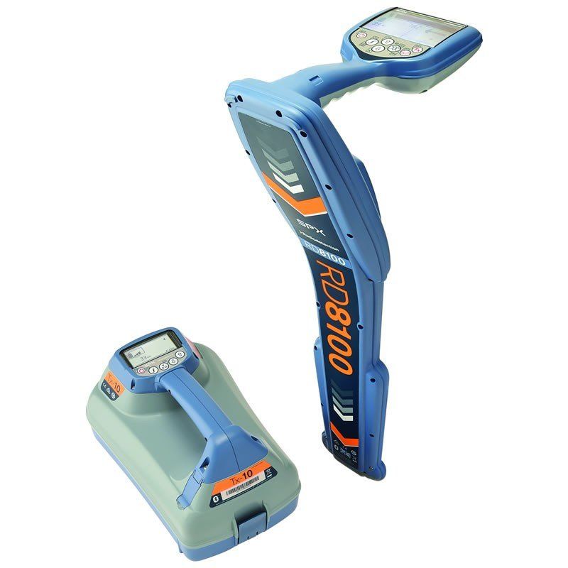
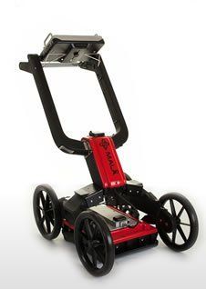
We use the leading Ground Penetrating Radar (GPR), Visual and Electro-magnetic equipment to create AutoCAD drawings of the utilities present on site. This gives a comprehensive plan of where the utilities are on the site.
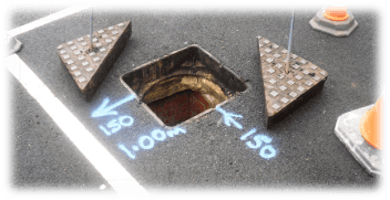
Our CCTV team can add drainage information, showing all connections, invert levels and flow direction. We can establish pipe sizes, class of drainage and offer a condition report from the recordings taken, identifying such problems as blockage or collapsed runs.
In addition, we can supply specialist radar surveys which can be used to locate voids in the ground and difficult to locate pipes and cables. We can also post process the data and build a 3d drawing, giving you a clear view of the results.
All of our utility surveys are carried out to PAS:128 BSI standards
Specific areas of experience include:-
►
Sewage & Water Treatment Works.
►
Large & Small Construction Sites.
►
Airports.
►
Hospitals & Schools.
►
Domestic Properties.
►
Boreholes.
Examples